
Los Haitises National Park
Los Haitises National Park in Samaná, Dominican Republic
Samaná is one of the most remarkable natural experiences you can have is a trip to Los Haitises National Park. Located around Samaná Bay, this protected area combines spectacular limestone formations, tropical rainforest, mangroves, small islands, caves and an important connection to the Taíno history of the Dominican Republic.
The park is one of the country’s most fascinating destinations for travelers interested in nature, wildlife, adventure and history. The Dominican Republic’s official tourism website describes Los Haitises as one of the jewels of the country’s national park system.
What Is Los Haitises National Park?
Parque Nacional Los Haitises is a protected natural area characterized by its distinctive karst landscape. Its name comes from the Taíno language and is generally associated with the idea of “mountainous land” or “high land.”
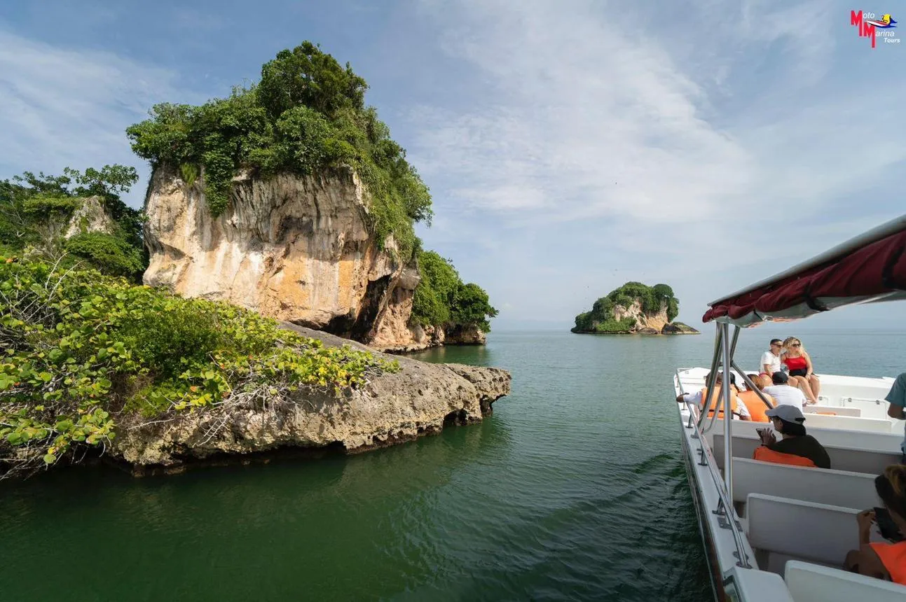
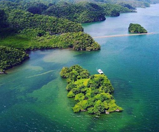
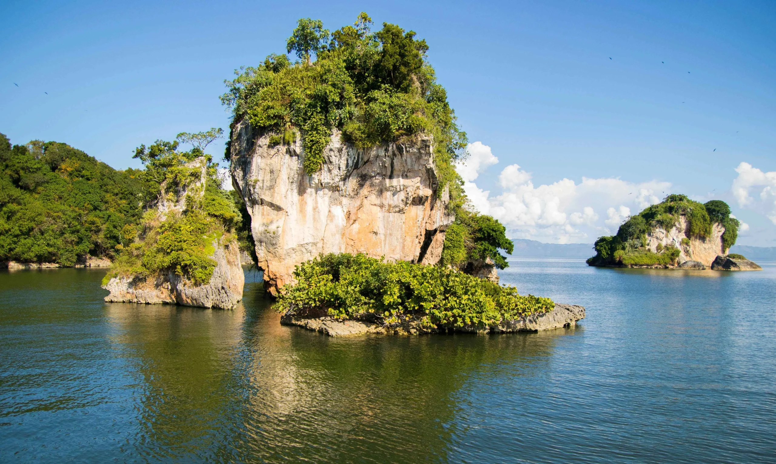
One of the first things visitors notice is the unusual landscape. Limestone formations rise from the waters of Samaná Bay, creating small islands and rocky outcrops surrounded by mangrove forests.
The official Dominican tourism information describes the park as covering approximately 1,600 km², although figures can vary depending on whether the broader protected area or a particular park boundary is being referenced.
Why Is Los Haitises So Special?
Los Haitises is much more than a beautiful place to take photographs. It is an important ecosystem where several different environments come together.
- Tropical rainforest
- Mangrove forests
- Limestone and karst formations
- A remarkable variety of birds
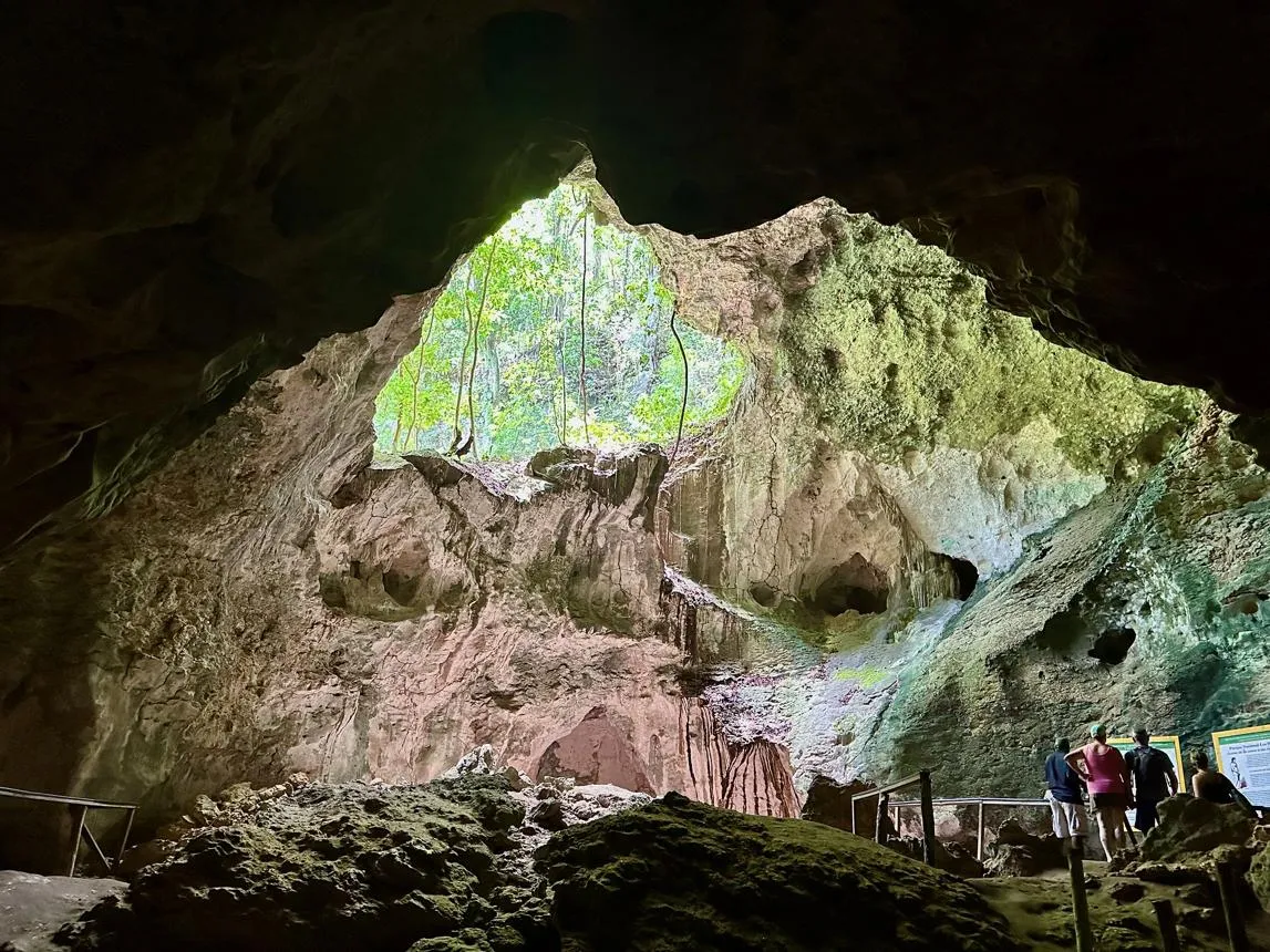
- Natural caves
- Boat and kayak excursions
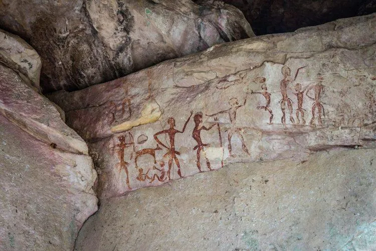
- Taíno pictographs and petroglyphs
- Small islands and coastal landscapes
The combination of these environments makes Los Haitises one of the most interesting ecotourism destinations in the Samaná region.
Exploring Los Haitises by Boat
For many visitors, the journey is just as memorable as the destination.
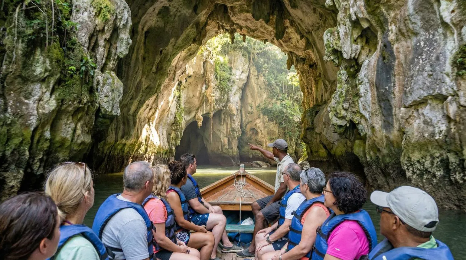
Excursions from Samaná typically travel across Samaná Bay, allowing visitors to see the park’s limestone formations from the water. The official tourism website specifically recommends exploring Los Haitises by boat from Samaná.
As the boat moves through the bay, the landscape gradually changes from open water to mangrove channels and impressive rock formations.
This is also an excellent opportunity for photography, especially when the weather is clear and the water is calm.
The Mangroves of Los Haitises
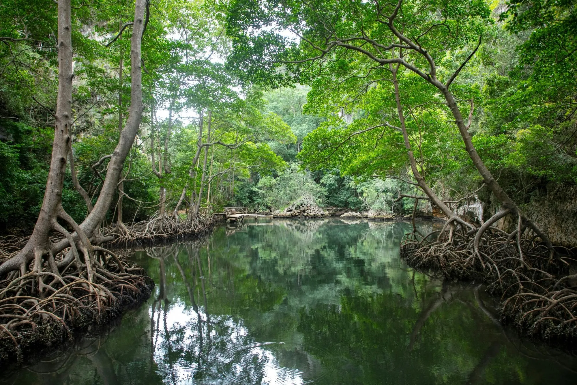
The mangrove forests are one of the defining features of Los Haitises.
These coastal ecosystems provide shelter and breeding areas for numerous species while also helping protect the coastline. Exploring the mangroves by boat or kayak gives visitors a completely different perspective of the park.
The official tourism information highlights kayaking through the park’s extensive mangrove system as one of the ways to experience Los Haitises.